In terms of Vanessa’s final project, unfortunately I was not able to access her Wix page at vszparko.wix.com/szparkohistory. This being said, my review today will be primarily focussed on Vanessa’s in-class presentation. Firstly, I think Vanessa has done an excellent job of explaining her process of sources and data acquisition and has been fairly knowledgeable on every source she has presented to the class. Vanessa has been quite fortunate to have access to so much material on her family history but it appears to have been well synthesized and the examples of the pages on her website proves that Vanessa made a good choice in choosing Wix as a host for her materials. I thought it was also a nice touch for Vanessa to have used contemporary photos as well as it provides a more linear, easy to understand record of her family history. On this point, I may hold a bias as I as well chose to include a substantial number of contemporary photos. I found Vanessa’s choice of Wix interesting for the type of project she is doing. Vanessa expressed that she found Wix to be a good, easy to use, but still functional platform for her project. From what I recall from her presentation, I think it did work for her quite well, especially for her desire to present the content of her website in a customizable fashion. In terms of the photos Vanessa has used, I think Wix was the right choice, especially over Omeka. As an Omeka user myself, I found some of the information that space on the site is set aside for quite frustrating and time consuming to fill out, especially with photos that I myself took (I, of course, understand the need for proper citation for other sources). With the exception of government issued documents, for which information would be very interesting to see, I think that the types of sources Vanessa is using, for example, family photographs and the like, are well suited to a more casual platform such as Wix. Additionally, I would assume that Vanessa will not encounter the same copyright fears that others might encounter as most of her sources are family sources and dated government documents. This makes the need for a site with detailed information segments unnecessary. All in all, I think Vanessa did a good job explaining tool acquisition. Though she perhaps could have touched on it a little more in her presentation, I can tell from Vanessa’s blog posts that she invested a significant amount of time and effort into her project and clearly this project worked well with Vanessa’s self directed learning abilities. Another aspect of her presentation which Vanessa did not touch upon much (probably because it is so self explanatory) is where her project fits within digital humanities as a broader subject. Obviously, the project is intended to be a family resource, but I am curious as to whether enough information is provided as to facilitate scholarship. Had I thought of it when Professor Ross suggested I ask a question or two, I would have inquired about this.
Tag Archives: History
Project Brainstorming: Class and Physical Space
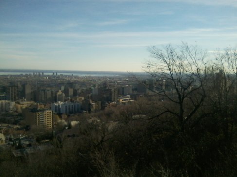
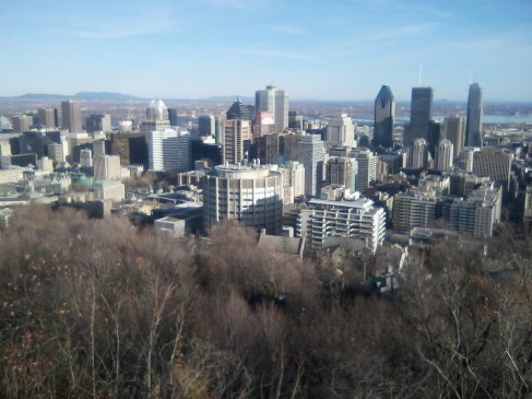
One idea which really interests me and which I would very much like to pursue as a final project is the idea of social class and physical space. In particular, I am interested in how and why social class and physical space overlap. Last semester, I spent a weekend in Montreal and during my time there I had a chance to walk to the top of Mount Royal to get a better look at the city. I had just recently read the book The Empire Within: Postcolonial Thought and Political Activism in Sixties Montreal for Professor Carstairs‘ HIST*4220 class which outlines the history of particular neighborhoods of Montreal. What I was struck by the most, was that the physical manifestation of social class outlined in The Empire Within is still visible. The picture below looks out over the neighborhoods of the traditionally working class south west. The south west of Montreal, as the hyperlink explains, is going through a period of regeneration, however its industrial working class heritage is still visible in comparison to the skyscrapers of the downtown core and the 19th century buildings of the McGill campus.

Looking Out Over the Southwest of Montreal
Downtown Montreal and Some Buildings from the McGill Campus
The exercise in GIS that our class did on January 22nd got me thinking about geography, social class, and change. The idea of layers of information seemed to fit quite well into the changing socio-economic and geographic makeup of not only Montreal, but other cities as well. Demographic information could not only legitimize, but enhance visualizations of changes to the composition of cities. Creating an interactive map which can illustrate interactions between socio-economic factors and geography is my prospective idea for my final project. Such a map could include photos, quantitative information, and layers emphasizing a changing historical context. I would like to investigate the possibility of making such a map for Guelph. I would also like to look into the resources available for such a project and discuss the feasibility of creating such a map. Additionally, I would like to see if there are chronological aerial photos of Guelph available for use. I am still in the developing stages in terms of this project to say the least and I am open to different ideas, suggestions, and feedback, so let me know what you guys think!